Eagle
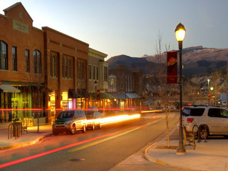
Eagle Colorado is the County Seat for Eagle County. It is located on I-70 about 20 minutes west of Beaver Creek and 30 minutes west of Vail. It has a rustic town center with restaurants, shops, services and all the county offices. Mostly single-family and duplex residences, but property listings may contain ranches and other large parcels.Demographic Information – https://en.wikipedia.org/wiki/Eagle,_Colorado
Scroll down to view Residential Whole Ownership Listings
… or Click here to View Active/Pending/Sold in List Form
Eagle
. Salt Creek Ranch Eagle, CO 81631
$9,995,000
Beds
5
Baths
7
SQ.FT
54,341
Active - Residential - Brush Creek Valley - Ranch
Eagle-vail 2 A&B
1200 Deer Boulevard Eagle-Vail, CO 81620
$3,350,000
Beds
10
Baths
8
SQ.FT
4,486
Active - Residential - EagleVail - Duplex
Frost Creek
367 Hunters View Lane Eagle, CO 81631
$2,700,000
Beds
4
Baths
4
SQ.FT
2,874
Active - Residential - Frost Creek - Single Family Residence
Eagle Ranch
17 Lone Spur Eagle, CO 81631
$2,650,000
Beds
6
Baths
7
SQ.FT
5,845
Active - Residential - Eagle Ranch - Single Family Residence
Frost Creek
216 Hunters View Lane Eagle, CO 81631
$2,600,000
Beds
4
Baths
4
SQ.FT
2,886
Active - Residential - Frost Creek - Single Family Residence
Other
2127 Salt Creek Road Eagle, CO 81631
$2,585,000
Beds
5
Baths
5
SQ.FT
5,230
Active - Residential - Eagle - Single Family Residence
Eagle Ranch
36 Robins Egg Lane Eagle, CO 81631
$2,399,000
Beds
5
Baths
7
SQ.FT
4,760
Active - Residential - Eagle Ranch - Single Family Residence
Frost Creek
448 Hunters View Lane Eagle, CO 81631
$2,375,000
Beds
4
Baths
4
SQ.FT
2,886
Active - Residential - Frost Creek - Single Family Residence
Frost Creek
333 Hunters View Lane Eagle, CO 81631
$2,260,000
Beds
4
Baths
4
SQ.FT
2,651
Active - Residential - Frost Creek - Single Family Residence
Frost Creek
86 Hunters View Lane Eagle, CO 81631
$2,242,000
Beds
3
Baths
3
SQ.FT
2,533
Active - Residential - Frost Creek - Single Family Residence
Eagle Ranch
2606 Eagle Ranch Road Eagle, CO 81631
$2,225,000
Beds
3
Baths
4
SQ.FT
4,622
Active - Residential - Eagle Ranch - Single Family Residence
Eagle-vail 2 A(East)
1200 Deer Boulevard Eagle-Vail, CO 81620
$1,995,000
Beds
5
Baths
4
SQ.FT
2,496
Active - Residential - EagleVail - Duplex